
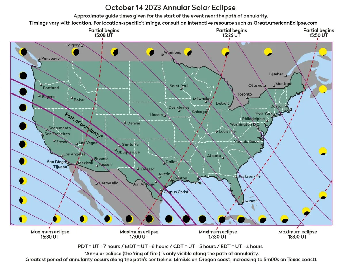
Excited about the October 14 annular solar eclipse? Download our October eclipse map below to help you observe the event this weekend.
In case you weren't already aware, a dramatic solar eclipse will be visible for observers in the USA on October 14 2023.
The centreline of the October 14 eclipse runs from Oregon, through Nevada, Utah, New Mexico, western into southern Texas.
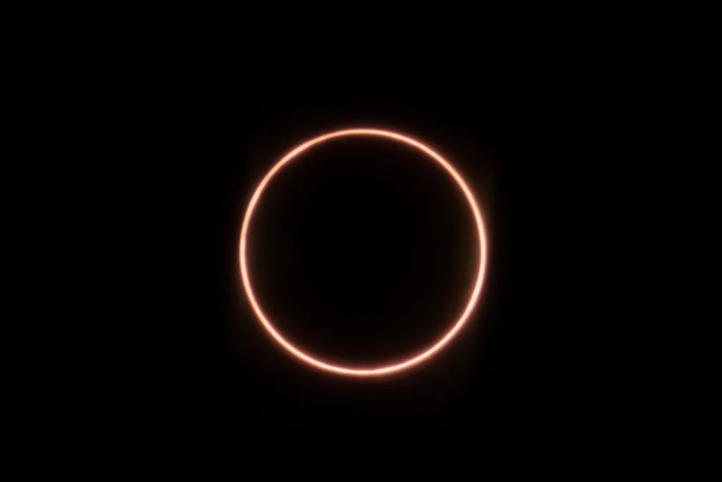
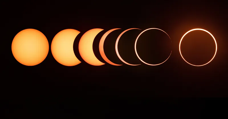
This will be an interesting eclipse because it’s not quite total, appearing from the centreline as an annular eclipse.
This is when the Moon passes centrally across the Sun’s disc but doesn’t fully cover it, leaving a so-called 'ring of fire'.
Away from the centreline, the rest of the US sees a partial solar eclipse of decreasing intensity moving further from the path of annularity.
The level of coverage should produce an interesting twilight effect for those near the centreline.
It's being touted as something of a warm-up for next year's April 8 total solar eclipse, but an annular solar eclipse is a spectacular event.
Also known as a 'ring of fire' eclipse, during an annular solar eclipse the Moon's silhouette doesn't quite cover the entire disc of the Sun.
Instead leaving a fiery ring hanging in the sky.
October eclipse maps
Click on each map below for a zoomed-in version you can download onto your computer or view on a smartphone or tablet.
October 14 annular solar eclipse map
The map below shows the path of annularity - i.e. where a full annular solar eclipse will be seen - across the USA.
It also reveals how much of the Sun will have a 'bite' taken out of it by the Moon's silhouette at different locations, and timings.
Use the map to work out what you'll see from your location, or where and when you need to be to experience full annularity.
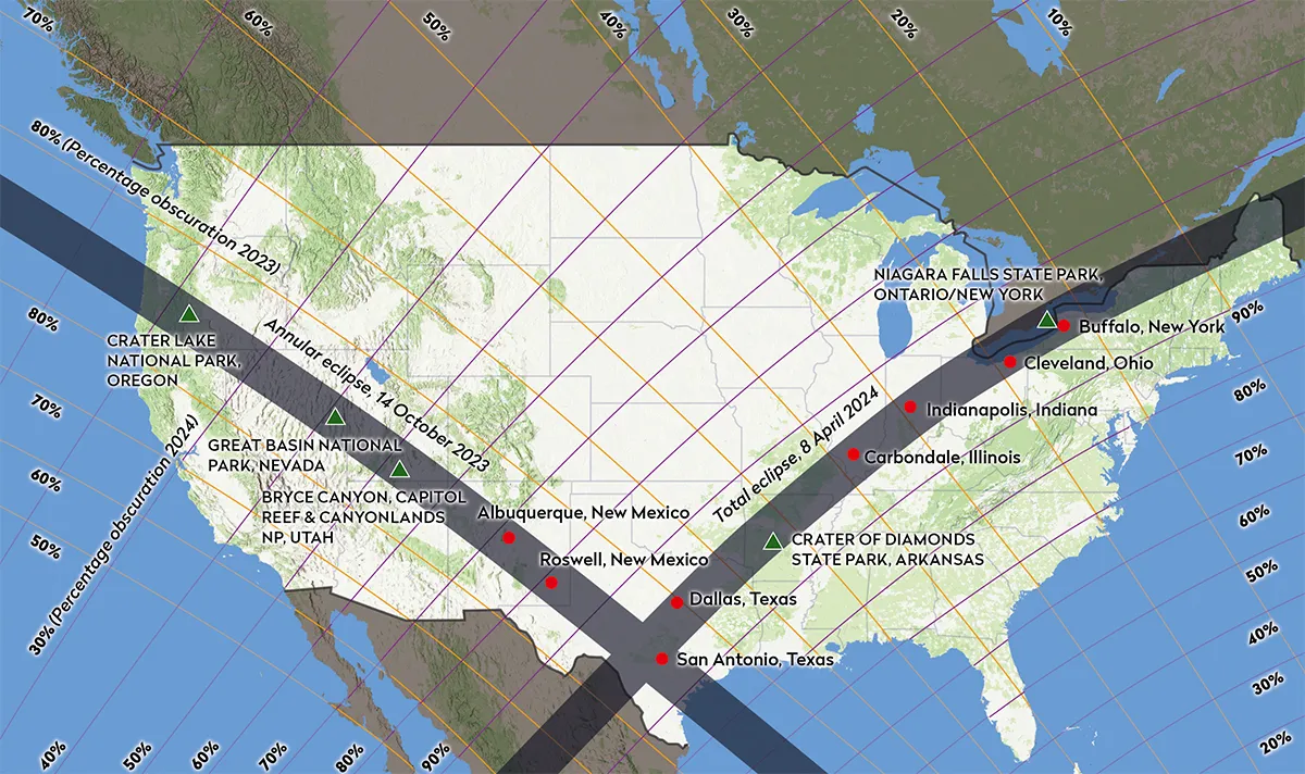
October 14 vs April 8 eclipse map
This map shows the path of the annular eclipse on October 14, as well as the path of the April 8 2024 total solar eclipse.
Red represent cities along the eclipse paths; green triangles are national and state parks.
Read more in our guide to the upcoming US eclipses
For more advice, read our guides on how to safely observe a solar eclipse and when the next eclipse is taking place.
Are you planning on observing or even photographing either eclipse? Let us know how you get on by emailing contactus@skyatnightmagazine.com.

