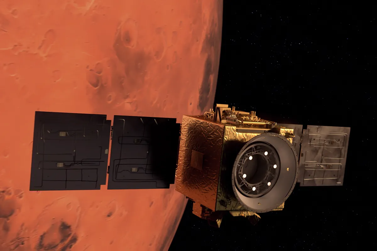
On 9 February 2021, the Hope Emirates Mars mission – the first interplanetary mission from the United Arab Emirates (UAE) – arrived at the Red Planet.
"The objective of the mission is to study the atmosphere’s variability for a full Martian year – two Earth years," says Hessa Al Matroushi, science lead on Hope.
"The maps we have from other missions to Mars have gaps in them. There would be measurements of the planet, say, two times a day and you’d have to predict what’s happening in between – that’s not accurate."
"Hope looks at the whole planet, surveying different layers of the atmosphere at different times of day, so we get full coverage. This is something that hasn’t been done before with such accuracy."
Hope began science observations in May 2021 and the team has now released the first set of maps from its Atlas of Mars, tracking atmospheric and temperature changes during the day.
This main science phase is set to cover one Martian year, giving a full picture of the Red Planet’s atmosphere.
Emirates Mars Mission's maps of the Red Planet
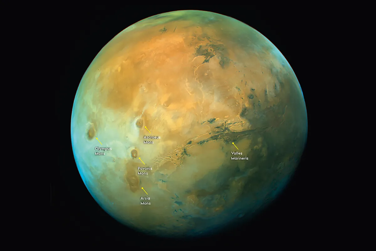
A global view of Mars
"Although the mission was designed to study the atmosphere, the surface is also a very important component, and we need to understand how the two interact together," says Al Matroushi.
To do this, Hope conducted a ‘capture’ orbit, where it came very close to the planet, allowing it to take higher resolution images of the surface.
It then moved out to its science orbit, which is wide to view the whole globe at once.
"That was exciting because you can do a lot of surface science – you’re able to see the rocks and the sand and study different regions, including Valles Marineris and Tharsis," says Al Matroushi.
Valles Marineris
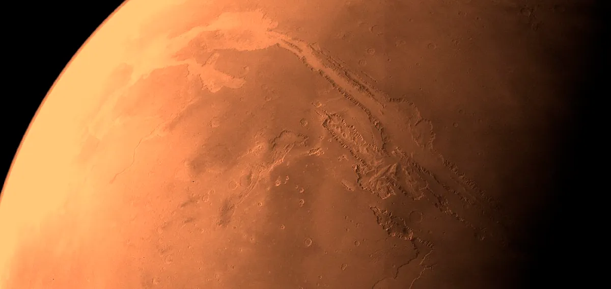
Valles Marineris is a 4,000km-long canyon that reaches depths of 7km – about five times deeper than the Grand Canyon on Earth. It is a tectonic crack, created four billion years ago as the planet cooled.
Tharsis region
The Tharsis region covers a geological hotspot that has been pushing the terrain upwards for billions of years, creating a 7km-high plateau. It is home to three of Mars’s largest shield volcanoes: Ascraeus Mons, Pavonis Mons and Arsia Mons (from north to south).
Olympus Mons
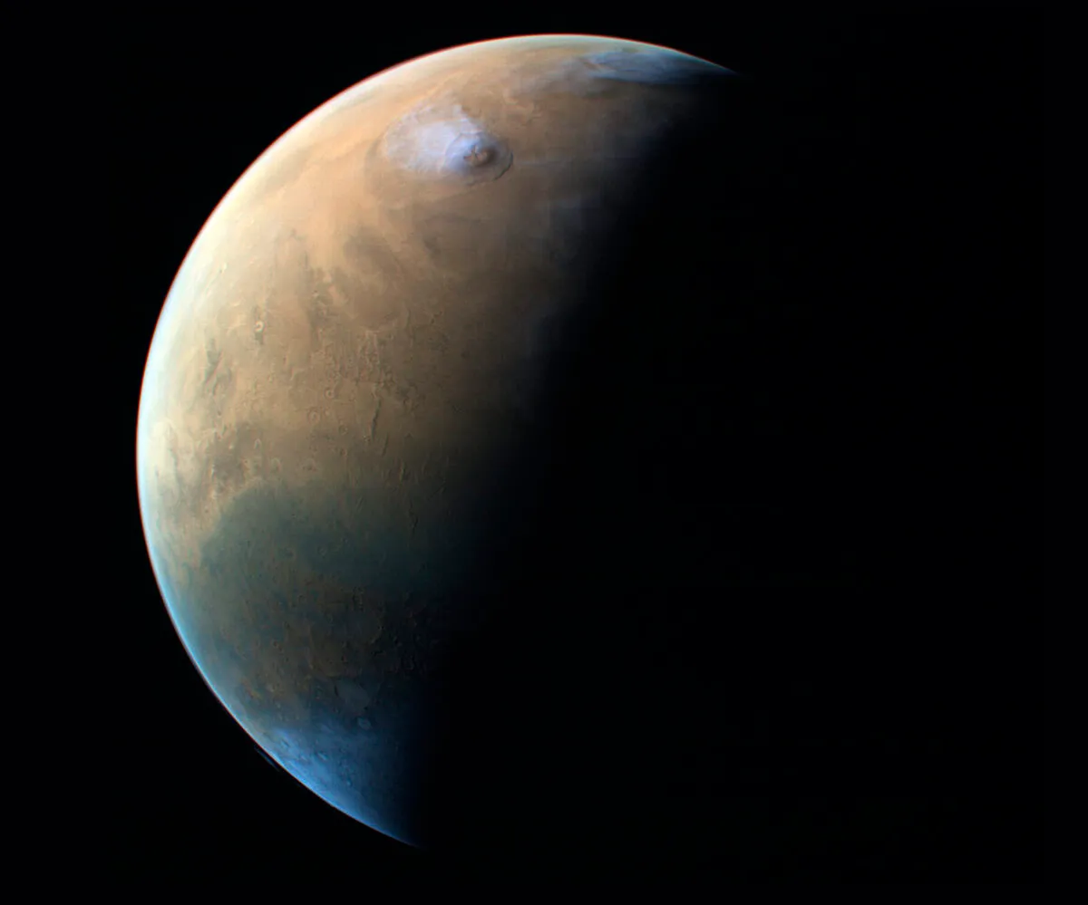
Olympus Mons, the Solar System’s largest volcano, lies to the west of Tharsis.
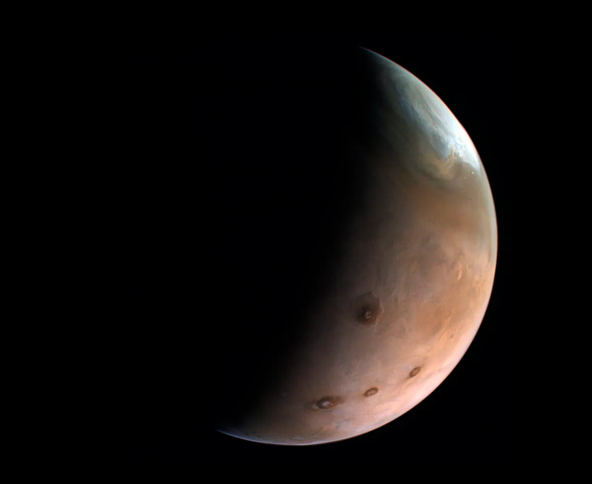
Temperature maps of Mars
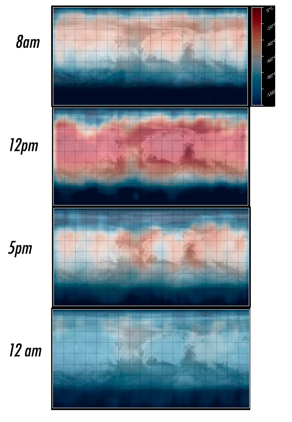
The Emirates Mars Infrared Spectrometer (EMIRS) looks at infrared light from Mars, generating heat maps of the entire planet at various points in the day.
"We’re looking into the globe’s temperature and understanding its variability, as that impacts the climate," says Al Matroushi.
This set of heat maps (above) was created in July 2021, in the season of spring for the Red Planet’s northern hemisphere, and it shows the change in temperature across the whole planet over an average day.
This article originally appeared in the June 2022 issue of BBC Sky at Night Magazine