The April 8 solar eclipse across North America was observed by milllions of people, including on the path of totality where the Moon completely blocked out the Sun's disk.
But what about a few of the April eclipse from space?
As the April eclipse made its way across Mexico, the USA and Canada, astronauts onboard the International Space Station caught a glimpse of the shadow of the Moon cast on Earth's surface.
And the US National Oceanic and Atmospheric Administration's (NOAA) National Weather Service has released footage of the Moon's shadow moving across Earth, captured by its Geostationary Operational Environmental Satellite (GOES).
See more images of Earth from space
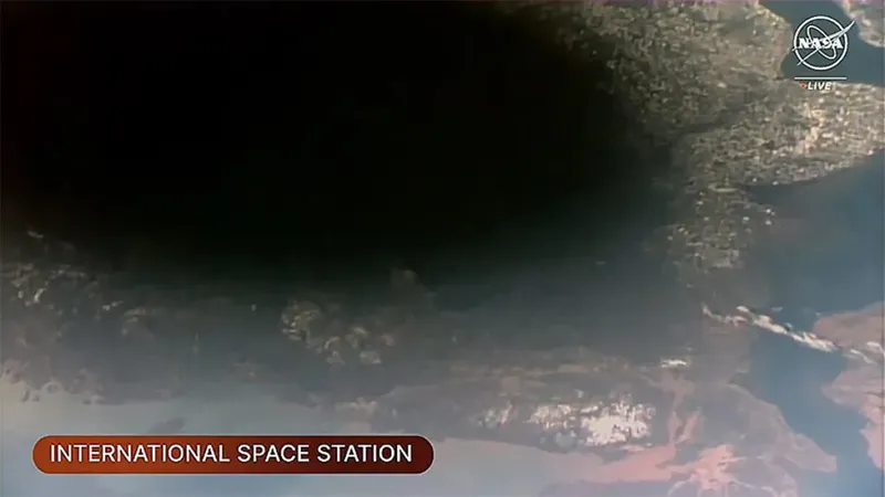
The Space Station's Expedition 71 crew were able to observe the shadow of the Moon on Earth from their vantage point 250 miles above Earth's surface.
NASA Flight Engineers Matthew Dominick and Jeanette Epps used the cupola section of the ISS - which offers astronauts incredible views of Earth - to observe and photograph the Moon's shadow while orbiting above southeastern Canada.
Meanwhile, the GOES satellite captured a series of images showing the Moon's shadow passing across the surface of the Earth between around 14:00 - 16:00 EDT (18:00 - 20:00 UTC).
This is perhaps one of the best views of the April eclipse from space.

The GOES satellites have been in operation since 1975 and are a jointly operated by NOAA and NASA to provide images and data on atmospheric conditions on Earth, as well as solar activity and how it affects our planet.
GOES satellites orbit 22,236 miles above Earth’s equator and travel at the same speed as Earth rotates, allowing long-term coverage of specific regions.
Did you observe the April 8 solar eclipse? Share your images and experiences with us by emailing contactus@skyatnightmagazine.com