Astronauts never fail to point out the beauty of seeing planet Earth from space, and it must be a surreal experience watching entire continents drift by as they orbit in the International Space Station.
But these images vary considerably in terms of how much of the entire globe of planet Earth is seen in one shot.
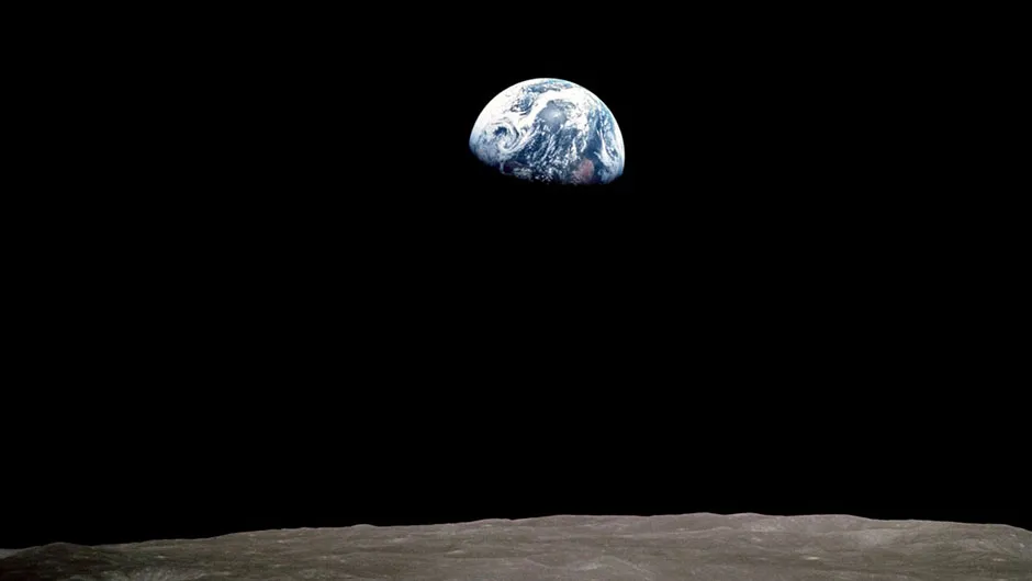
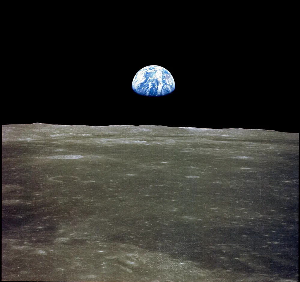
The famous Earthrise picture was taken by Apollo 8 lunar module pilot Bill Anders on Christmas Eve 1968, about 230,000 miles from Earth. Credit: NASA
Depending on during which mission the image of Earth was captured, you might be able to make out the intricate detail of lakes and rivers, towns and cities, or simply the whole blue disc of our planet set against the inky backdrop of deepest, darkest space.
So how far away does an astronaut need to be in order to observe the whole of planet Earth in one go?
To see the whole of our planet in one view, an astronaut would have to be further away than you may imagine.
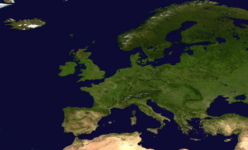
As an example, from 300km (200 miles) above 52ºN 0ºW, only Europe is seen, and at 1,000km (600 miles) much of northern Africa becomes visible, but with less surface detail.
A satellite image showing Europe from space. Credit: NASA/Goddard Space Flight Center
By 36,000km (22,000 miles) above the ground, the full disc of planet Earth could be seen by a human being.
This latter altitude is the position of a geostationary satellite, a satellite that appears to be in a fixed position because it revolves around the equator once per day, and it needs three of these satellites to give a full view of the planet.
To put this into perspective, the International Space Station orbits Earth from a distance of about 250 miles (400km), which is why images of Earth captured from the Space Station reveal so much detail.
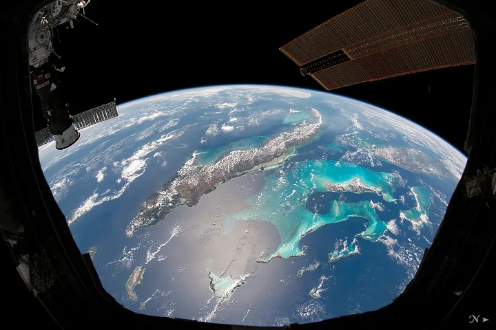
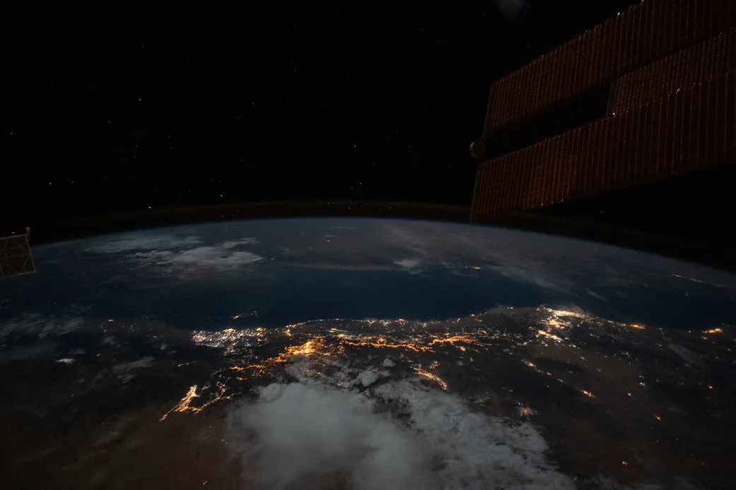
An astronaut’s view of the Caribbean from space. The land mass in the centre is Cuba; on the far right is Florida. In between is the Bahamas. Credit: NASA
You can experiment with this yourself by using the website Fourmilab, where you can get a view of Earth from any point of altitude, latitude or longitude.
And Google Earth of course helpfully tells you how far its 'camera' is from ground level, meaning you can zoom in and out to see what the perspective is from different distances.
Zoom into 400km and you'll get an idea of how ISS astronauts see Earth; you'll realise it's much closer than you might have imagined.
Gallery: Images of Earth from space
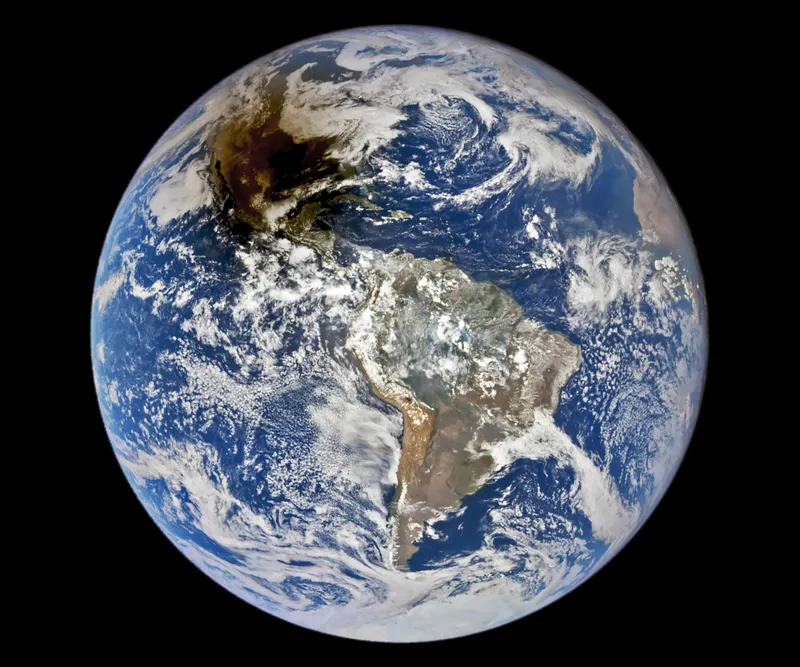
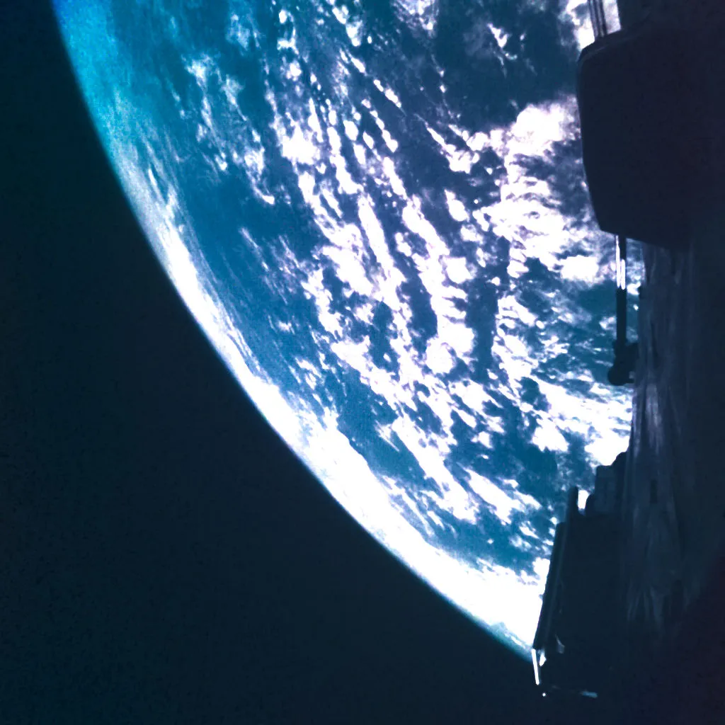
Earth and the Pacific Ocean from space, as seen from the International Space Station. Credit: NASA
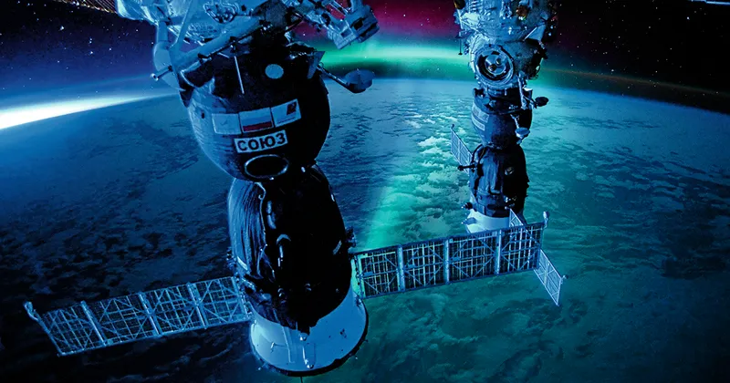
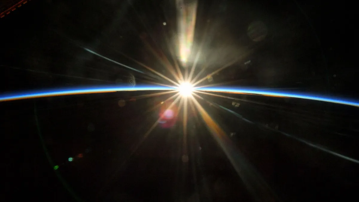
A view of the Soyuz capsule and aurora over Earth, captured from the International Space Station by ESA astronaut Thomas Pesquet, featured in his book The Earth in Our Hands. Credit: Firefly Books
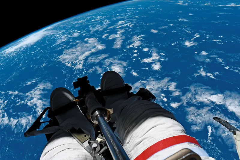
The dangling feet of astronaut Thomas Pesquet during a spacewalk on the International Space Station, with Earth below. Captured by ESA astronaut Thomas Pesquet, featured in his book The Earth in Our Hands. Credit: Firefly Books
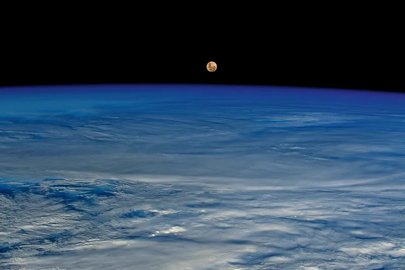
What the Moon looks like from space. The Moon over Earth, as seen from space, captured by ESA astronaut Thomas Pesquet, featured in his book The Earth in Our Hands. Credit: Firefly Books
What a solar eclipse looks like from space. The Moon's shadow cast on Earth during the October 14 2023 annular solar eclipse, captured by NASA's DSCVR (Deep Space Climate Observatory). Credit: courtesy of the DSCOVR EPIC team
Earth from space, captured by the
JUICE explorer, 14 April 2023
Credit: ESA/Juice/JMC, CC BY-SA 3.0 IGO
Earthrise, as Apollo 11 comes around the limb of the Moon to see an isolated Earth hanging in the black abyss of space. Credit: NASA.
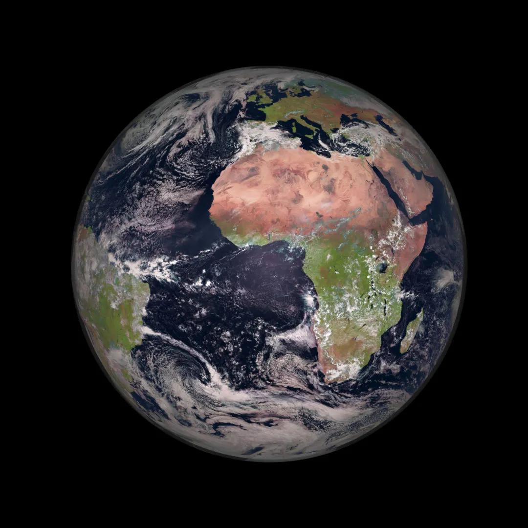
Earth captured by
METEOSAT-2, 23 March 2022
IMAGE CREDIT: EUMETSAT/ESA
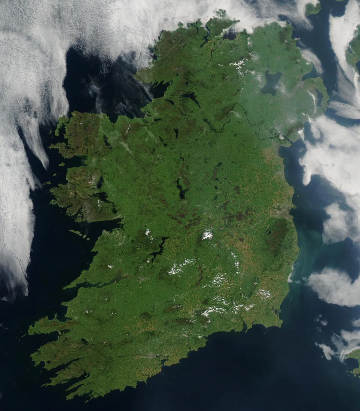
This image of Ireland was captured by the MODIS instrument onboard the Earth-orbiting Aqua satellite on 7 August 2003. The satellite's mission is to monitor natural systems on Earth and in the oceans, in order to better inform environmental protection.
Easily discernable on the map is Dublin, the capital city of the Republic of Ireland, which can be seen about halfway down the east coast. Just south of the city, the light blue-green smudge in the Irish Sea is actually drifting phytoplankton.
Credit: Jeff Schmaltz, MODIS Rapid Response Team, NASA/GSFC
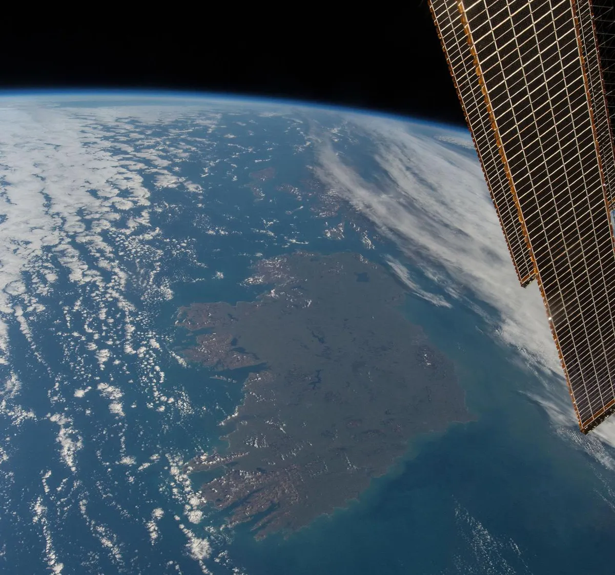
This breathtaking photo of Ireland was captured by former NASA astronaut Terry Virts on 13 March 2015 from the International Space Station. The clouds seem to have parted to enable Virts to get the shot, just 4 days ahead of St Patrick's Day. Easily discernible in the northeast of the island is Lough Neagh, located in Northern Ireland and the largest freshwater lake on the whole island.
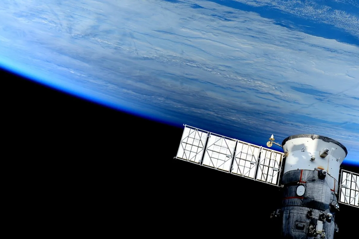
Also visible in the image are the curvature of the Earth and solar panels providing solar energy to the ISS.
Credit: NASA/ESA/Terry Virts
The Earth from the Tianhe core module on China’s space station,
TIANGONG SPACE STATION, 30 JULY 2021
Image credit: Tang Hongbo/China Manned Space Engineering Office
The last image of the whole Earth taken by a human being, during Apollo 17, 17 December 1972. Credit: NASA / restored by Toby Ord
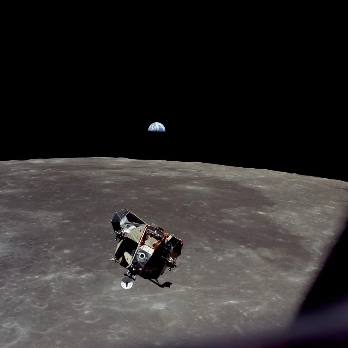
Apollo 11 astronaut Michael Collins captured this image of the Lunar Module carrying Neil Armstrong and Buzz Aldrin back up to the Command Module after the mission that made them the first humans to step foot on the Moon, 21 July 1969. Credit: NASA / restored by Toby Ord
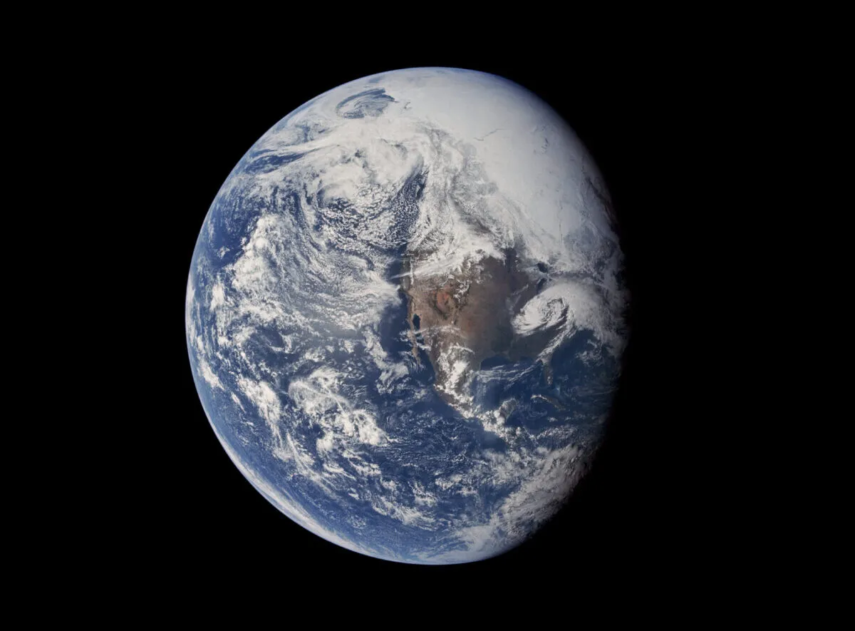
A remarkable view of Earth from Apollo 16, taken on 16 April 1972, reveals a world of blue and white with a hint of brown. Credit: NASA / Toby Ord
A view of Earth over western Australia captured by astronaut Dick Gordon during Gemini XI. Credit: NASA/Dick Gordon
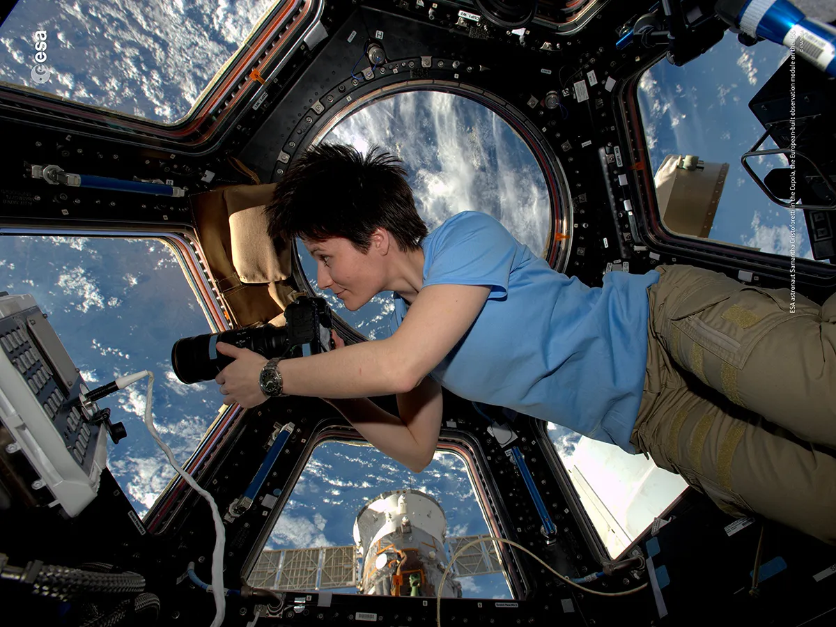
ESA astronaut Samantha Cristoforetti points her camera out the Cupola on the International Space Station to capture an image of Earth. Credit: ESA/NASA
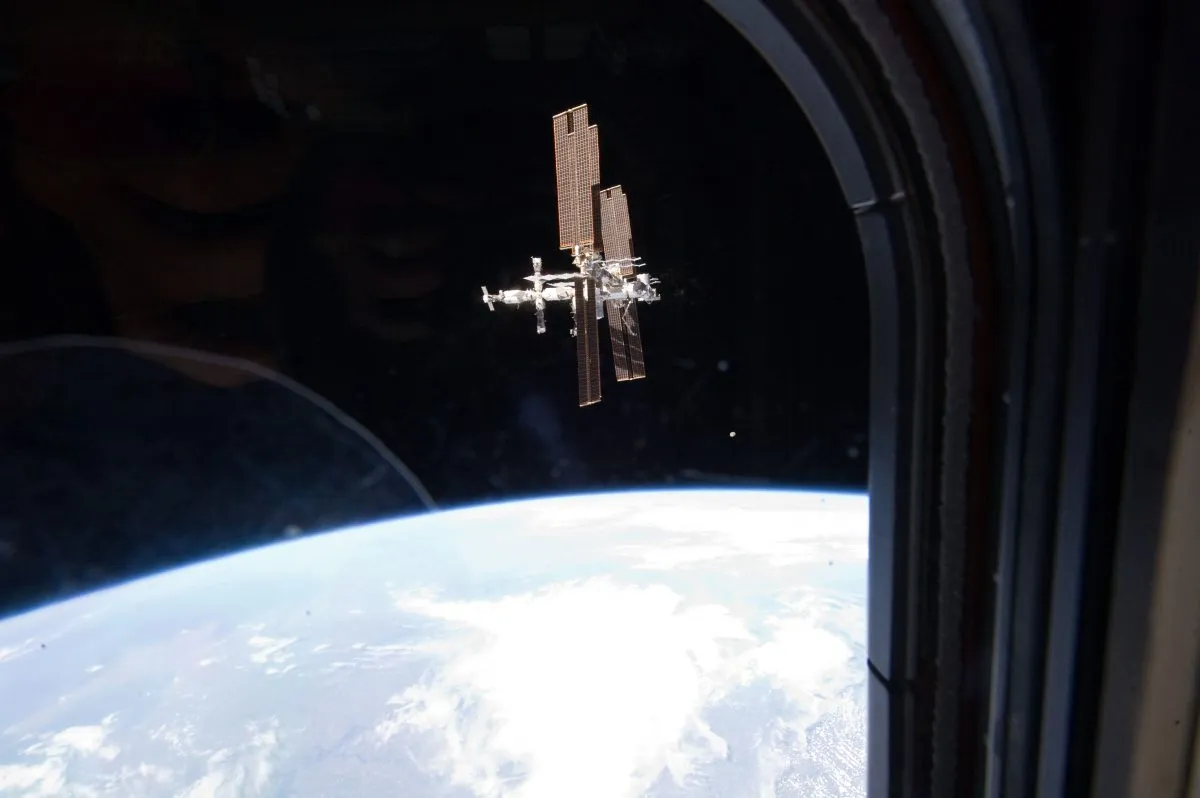
The construction of the ISS was undoubtedly one of the Shuttle’s biggest achievements. Here, the Space Station is seen orbiting Earth through the window of Space Shuttle Atlantis, 19 July 2011. Credit: NASA
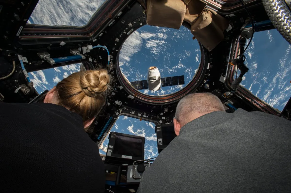
Jeff Williams and Kate Rubins prepare to grapple the SpaceX Dragon supply spacecraft on its arrival from Earth to bring around 2000kg of supplies, equipment and science hardware to the ISS. Credit: NASA
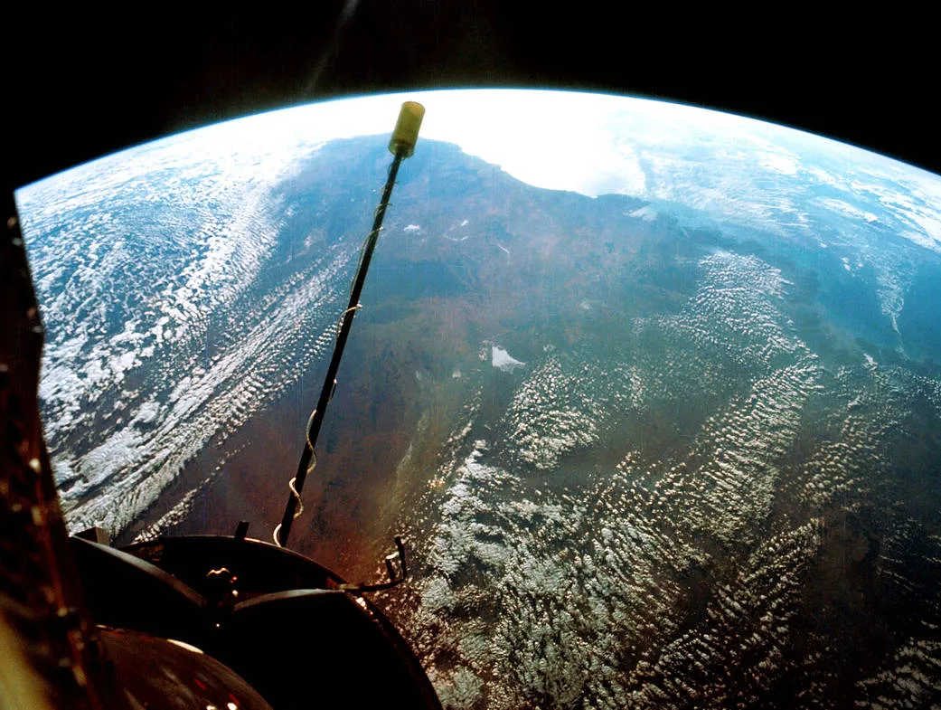
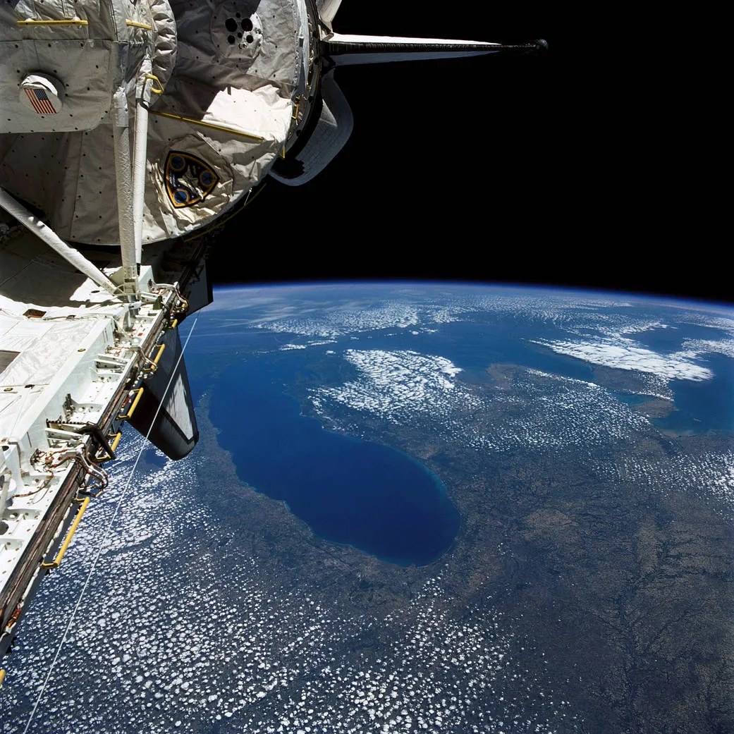
A view of Earth captured during Columbia mission STS-40, which launched on 5 June 1991 to carry the fifth Spacelab mission. Credit: NASA
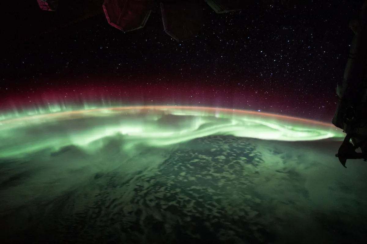
An image of the aurora over Earth, as seen from the International Space Station on 26 June 2017. Credit: NASA
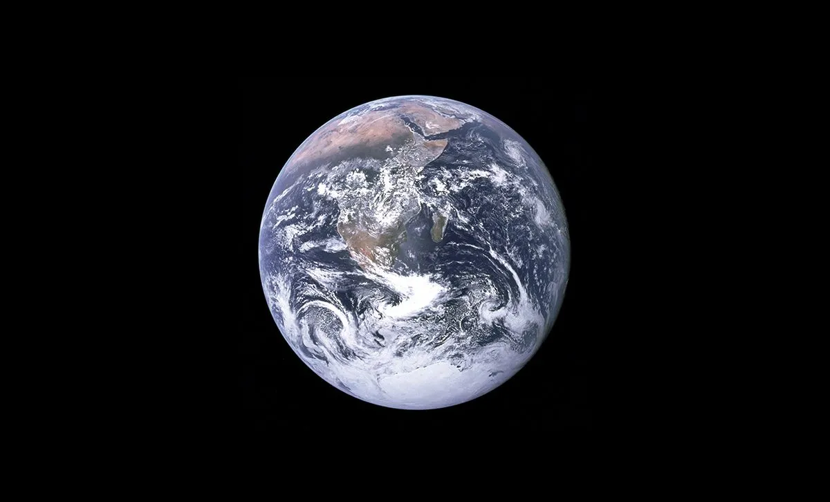
The famous 'Blue Marble' image of Earth captured during Apollo 17 revealed our planet as a beautiful yet fragile planet for the first time. Credit: NASA
Earth from space: the Red Sea Coast of Saudi Arabia captured from the International Space Station. Credit: NASA/ESA
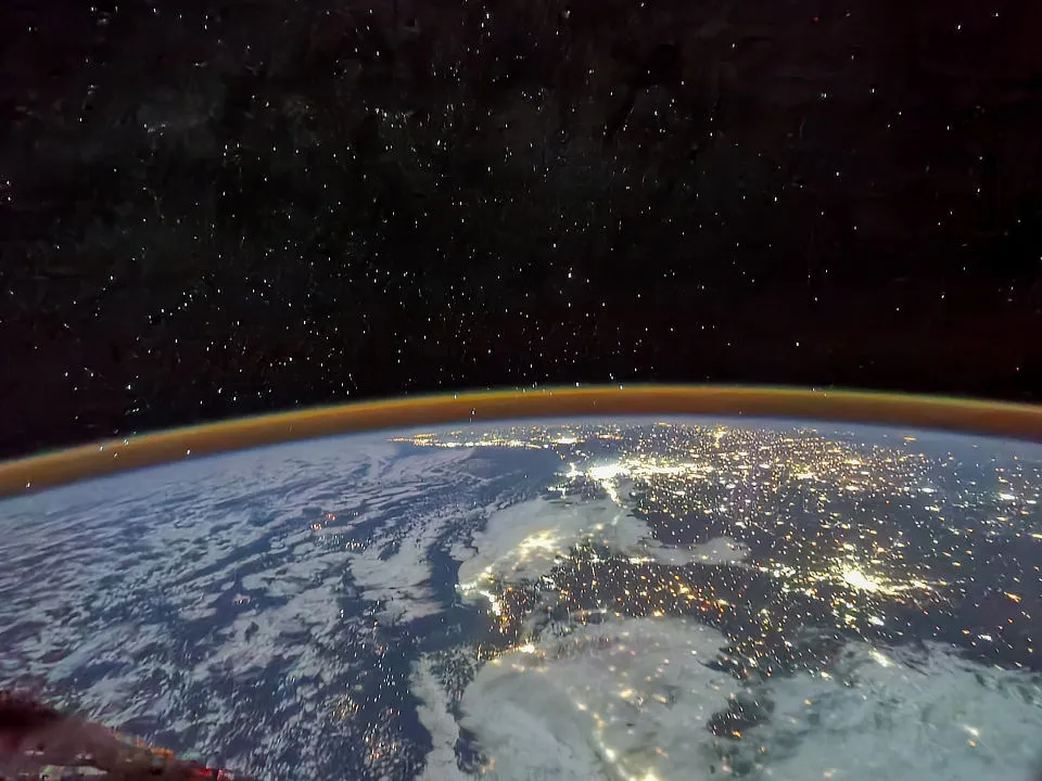
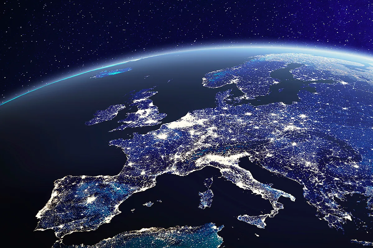
An image of Europe at night from space, showing the distribution of artificial light. Credit: NicoElNino/istock/getty images
An image of Earth captured from the International Space Station by Samantha Cristoforetti, 20 March 2015. Back on Earth, Europeans enjoyed the sight of a partial solar eclipse. Credit: ESA/NASA