, processed by ESA")
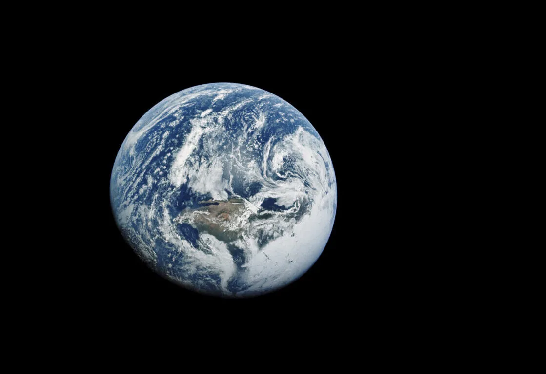
Photos of Earth from space never fail to amaze. The fragility of our home planet is even more pronounced when seen against the vast, inky black void of the cosmos.
One thing astronauts who have spent time on the International Space Station or the Space Shuttle often say is how from Earth orbit, our home planet can be seen not as a map of individual countries and territories, but as an inter-connected whole.
Borders disappear, and a new perspective of planet Earth is achieved (which we found out during our interview with NASA astronaut Nicole Stott).
For more images of our planet, view our gallery of newly restored Apollo pictures of Earth from space.
The island of Ireland makes for a great photo opportunity from Earth orbit: it is small enough to fit in a single field of view, and its distinctive outline is familiar and easily recognisable.
We've taken a look through the ESA and NASA archives to dig out pictures of Ireland from space, as seen by both human and robotic explorers.
Here is a selection of some of our favourite photos of Ireland from space, and info surrounding how they were captured, and what they reveal about our home planet.
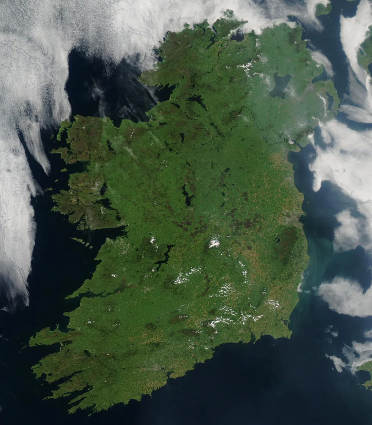
This image of Ireland was captured by the MODIS instrument onboard the Earth-orbiting Aqua satellite on 7 August 2003. The satellite's mission is to monitor natural systems on land and in the oceans in order to better inform environmental protection.
Dublin, the capital city of the Republic of Ireland, can be seen about halfway down the east coast as a grey region. Just southeast of the city, the light blue-green smudge in the Irish Sea is a swarm of drifting phytoplankton.

Clear weather enabled the European Space Agency's Copernicus Sentinel-3 mission to captured this view of Ireland from space in January 2024.
Also visible on the right side of the image are the western shores of Scotland, Wales and southwest England.
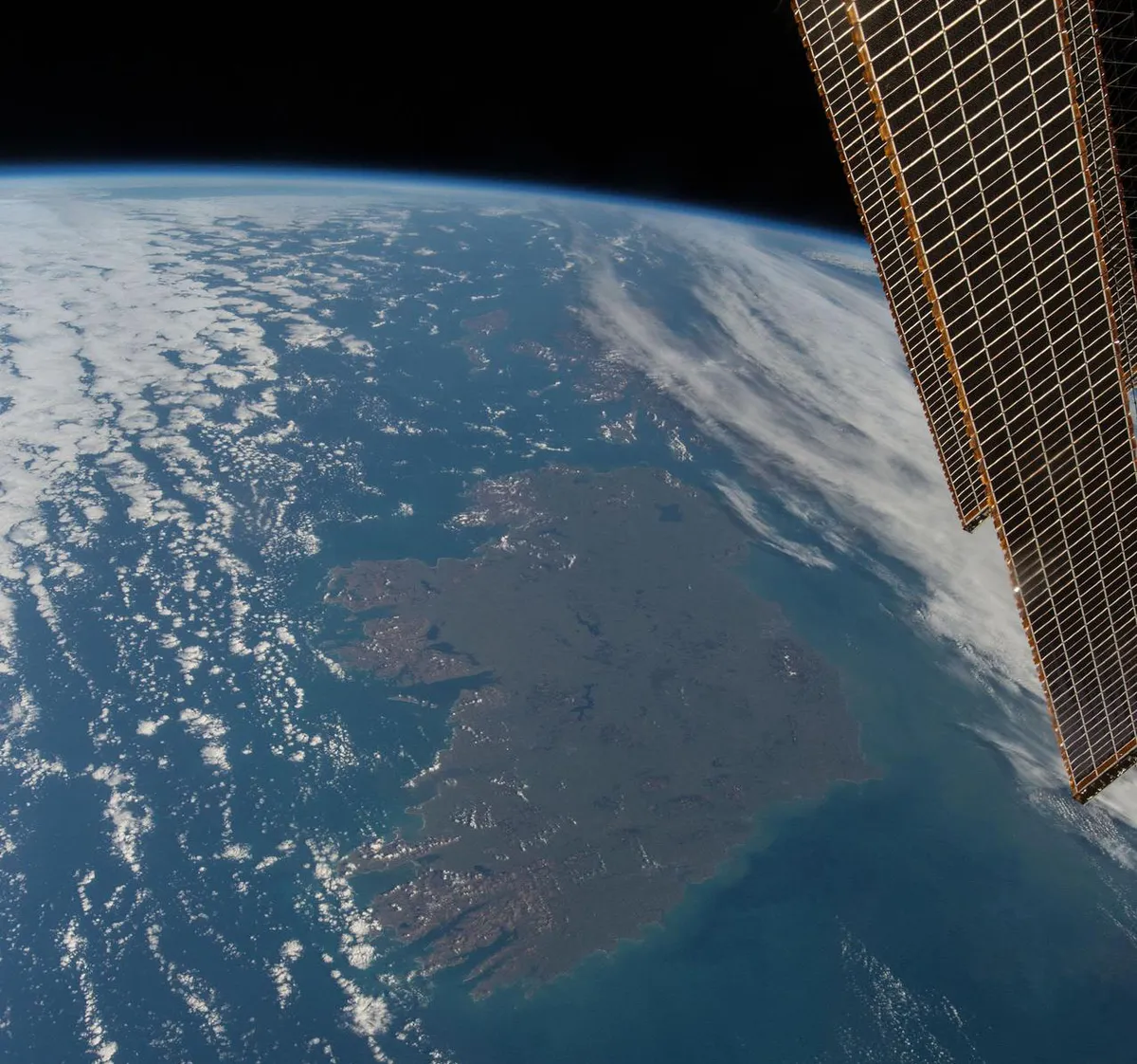
This breathtaking photo of Ireland was captured by former NASA astronaut Terry Virts on 13 March 2015 from the International Space Station. The clouds seem to have parted to enable Virts to get the shot, just 4 days ahead of St Patrick's Day.
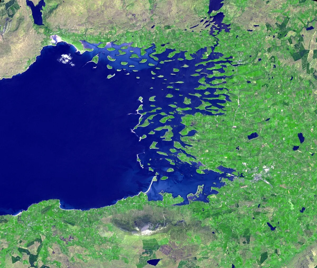
The large body of water seen in the northeast is Lough Neagh, which is a popular beauty spot in Northern Ireland and the largest freshwater lake on the whole island.
Also visible in the image are the curvature of the Earth and, in the foreground, solar panels providing solar energy to the ISS.
Watch our interview with Terry Virts to find out more about the astronaut's time on the ISS.
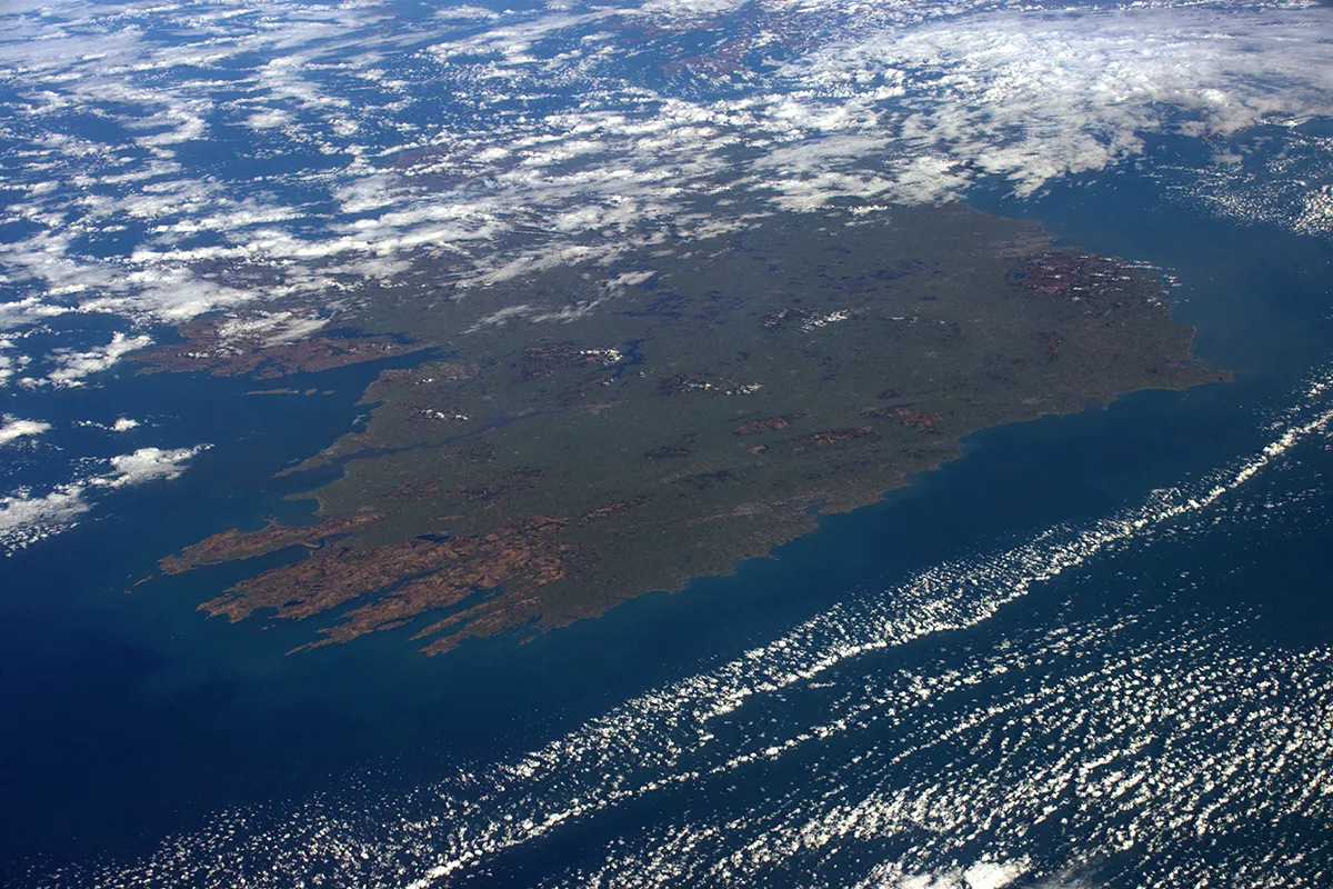
The northern half of Ireland is partly covered in cloud in this image captured by UK astronaut Tim Peake during his Principia mission on board the International Space Station.
Peake captured the image on 24 February 2016 and posted it to his Flickr account a few weeks later, just in time for St Patrick's Day.
NASA's Space Shuttle and the astronauts who worked on it launched a vast array of astronomical and scientific instruments into space, including the Hubble Space Telescope.
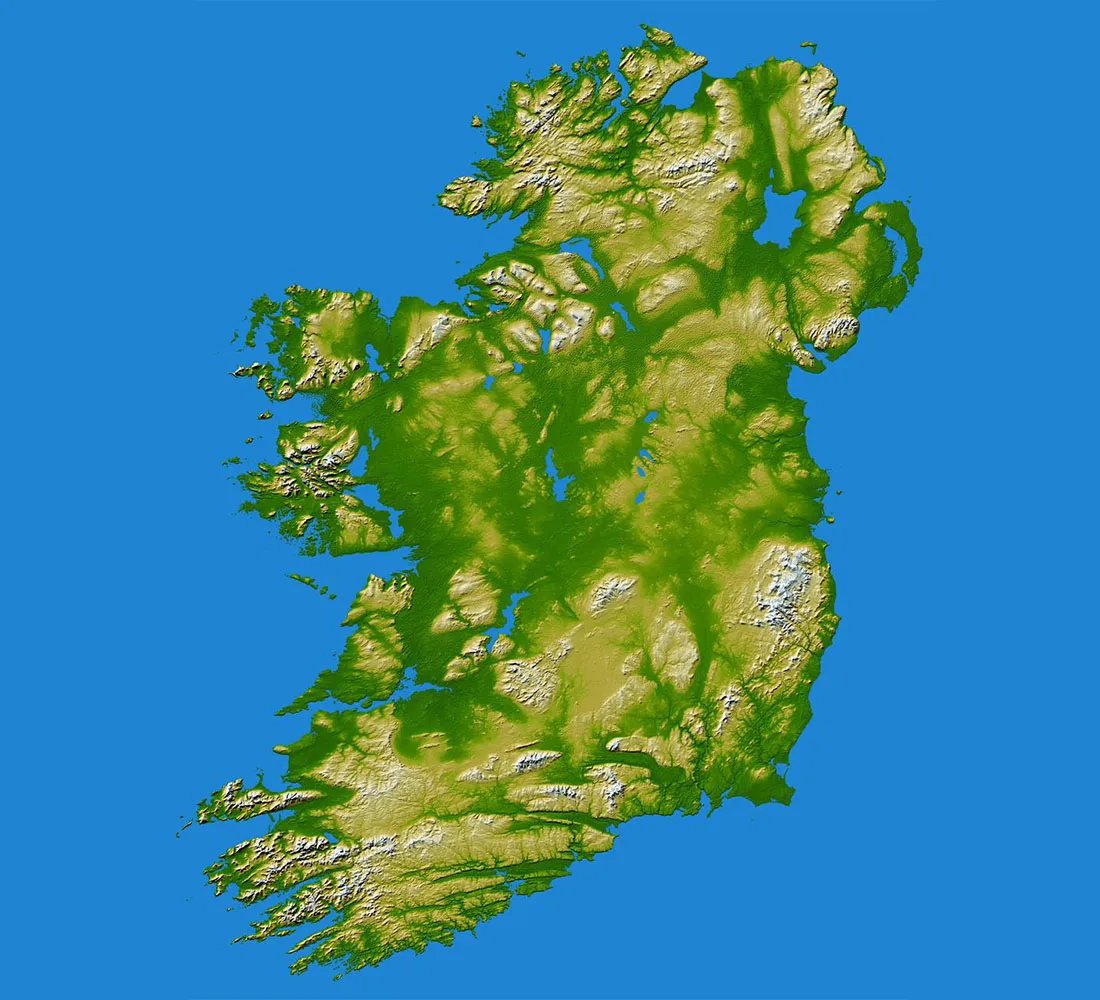
One Shuttle mission that's less well-known was the Shuttle Radar Topography Mission, which flew aboard Space Shuttle Endeavour between 11-22 February 2000.
A collaboration between NASA and the National Geospatial-Intelligence Agency, its goal was to gather radar data and compile a portfolio of land elevations across the globe.
This image of Ireland was captured as part of the mission and shows the island's hills, mountains and other geological structures.

This view of Ireland captured by the European Space Agency's Sentinel-1A satellite is colour-coded, revealing the geological and geographical makeup of the island's surface.
The different colours show changes in the land across a period of 12 days.
Blue shows strong changes in bodies of water or agricultural activities; yellow shows cities and urban populations (note Dublin halfway down the east coast and Belfast in the northeast); fields and forests are green; red and orange shows unchanging features like bare soil and rocks.
This image isn't of Ireland as a whole, but of Clew Bay in County Mayo, not far from Mayo Dark Sky Park (one of the best places for stargazing in Ireland).
NASA's ASTER instrument (Advanced Spaceborne Thermal Emission and Reflection Radiometer) aboard the Earth-orbiting Terra satellite was designed to capture hi-res images of Earth for the purposes of generating detailed maps that reveal land surface temperature, elevation, the effects of climate change and extreme weather.
ASTER captured this image of Clew Bay on 31 May 2016.
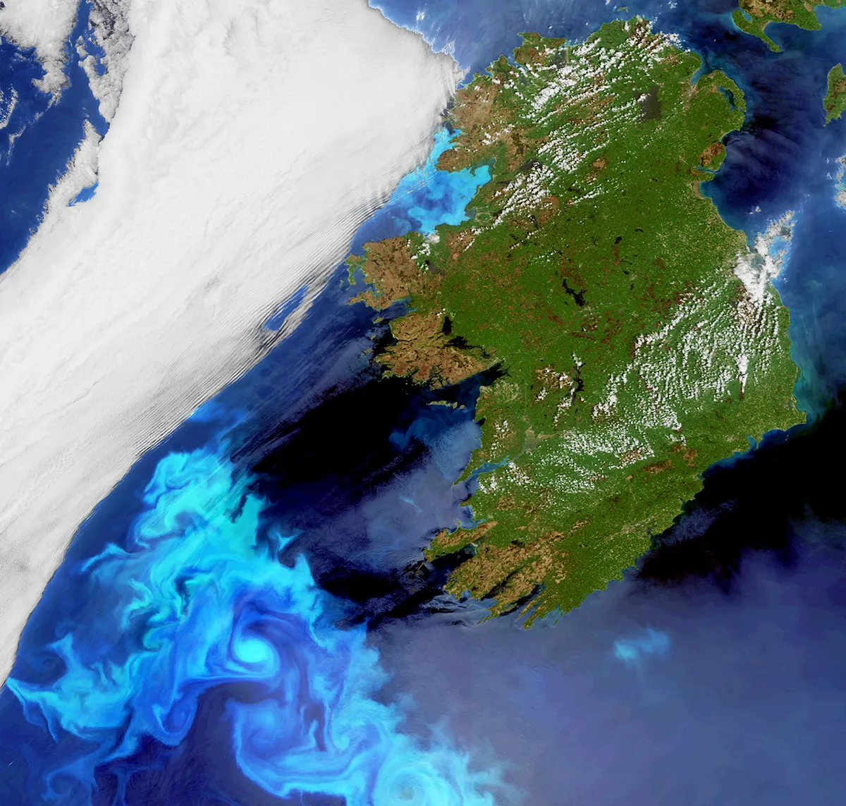
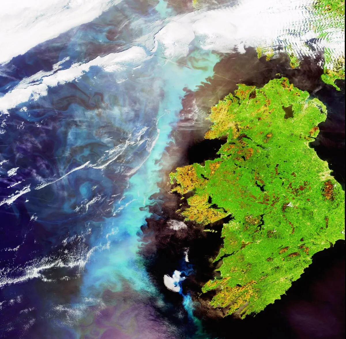
While the eye is immediately draw to the distinctive, deep green of the Irish land mass, perhaps more striking are the wisps of light blue to the south west of the island.
These are blooms of plankton - microscopic marine plants - captured by the European Space Agency's Envisat satellite on 23 May 2010.
Plankton cannot be seen with the naked eye, but during photosynthesis, chlorophyll colours the surrounding water and can be seen from space.
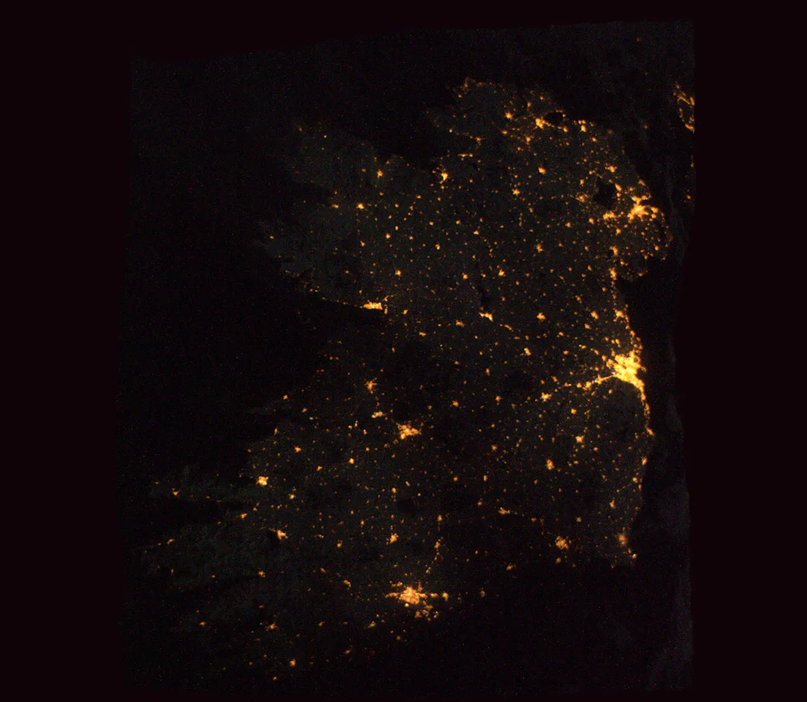
This image of Ireland at night was captured by ESA astronaut Paolo Nespoli on Christmas Day 2010 from the International Space Station.
The major cities of both Northern Ireland and the Republic of Ireland can be clearly seen: Belfast in the northeast; Dublin halfway down the east coast; Cork City in the south.
While this makes for an interesting image for anyone to enjoy, it could be of particular use to amateur astronomers as it serves as a light pollution map highlighting the brightest and darkest regions on the island.
This is another image captured by the Envisat satellite showing an impressive algae bloom off the west coast of Ireland.
Envisat's Medium Resolution Imaging Spectrometer was equipped to identify plankton concentrations from space, and managed to capture this huge bloom on 6 June 2006.

